
A better way to survey
At Frontier Drone Works, we turn aerial data into actionable insight. From construction progress mapping and volumetric surveys to golf course turf analysis, inspections, and large-scale land visualization, we help clients see their projects from an entirely new perspective.
FAA Part 107 Certified • Hawaii Based
Construction Mapping & Progress Tracking
Monitor site development with accurate aerial data, orthomosaics, and visual progress updates.
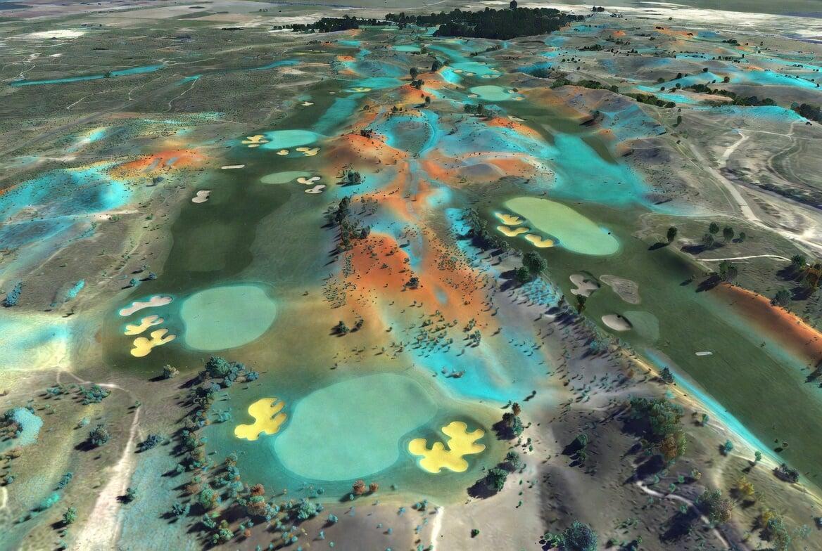
Golf Course Turf & Land Analysis
Gain a new perspective on course conditions, drainage patterns, and land management.