Construction Mapping & Progress Tracking
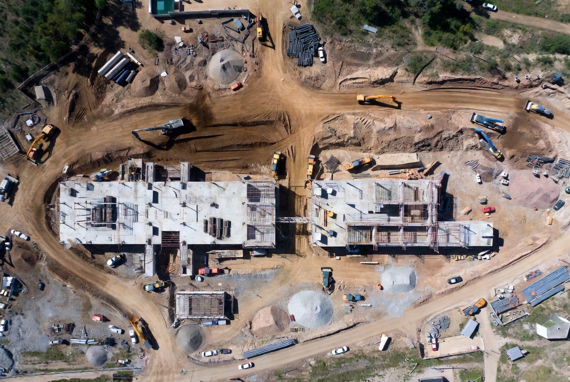
Description
Monitor your project from above with accurate aerial mapping and consistent progress documentation. Frontier Drone Works provides high-resolution imagery, orthomosaic maps, and site progress updates that help teams improve visibility, communication, and decision-making throughout every phase of construction.
From earthwork tracking to visual reporting for stakeholders, our aerial data helps keep projects organized, efficient, and moving forward.
Deliverables
Orthomosaic Maps • Progress Reports • Site Documentation • Earthwork Visualization • Aerial Photography
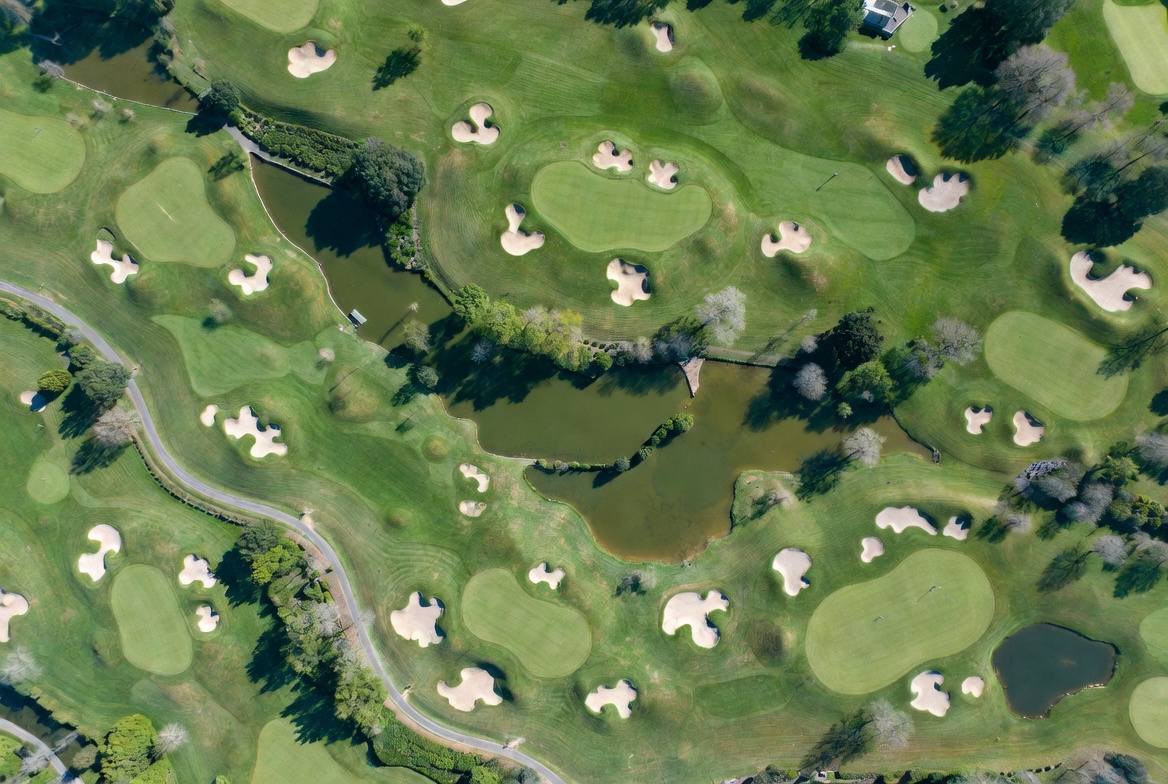
Golf Course Turf & Land Analysis
Description
Gain a new perspective on course conditions through aerial imagery and drone-enabled turf analysis. We help golf courses better visualize drainage patterns, turf stress, land movement, and overall course conditions from angles not visible at ground level.
Our goal is to provide superintendents and course managers with valuable visual insight that supports smarter maintenance and long-term course management.
Deliverables
Aerial Course Imaging • Turf Visualization • Drainage Observation • Course Flyovers • Seasonal Documentation
Aerial Course Imaging • Turf Visualization • Drainage Observation • Course Flyovers • Seasonal Documentation
Drone Inspections
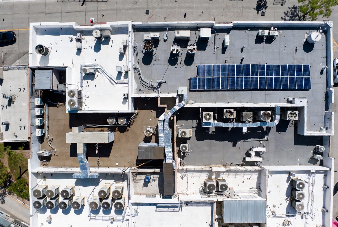
Description
Safer, faster, and more efficient inspections without the need for ladders, lifts, or extensive manual access. Frontier Drone Works captures high-resolution aerial imagery for rooftops, structures, equipment, and property assets while minimizing disruption and improving safety.
We provide detailed visual documentation that helps property owners, contractors, and managers better assess conditions and identify areas of concern.
Deliverables
Roof Inspections • Infrastructure Imaging • Property Assessments • High-Resolution Photo Capture • Visual Reporting
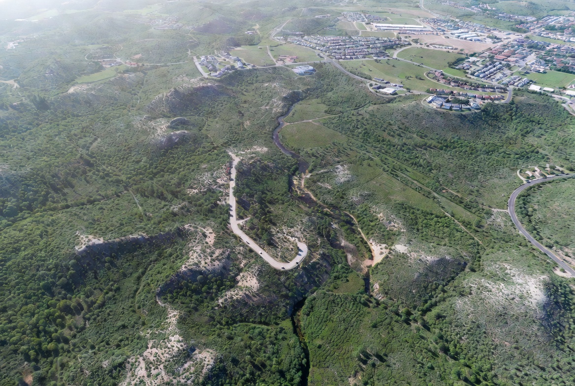
Aerial Mapping & Visualization
Description
Transform land and property into detailed visual data through modern drone mapping technology. We create aerial imagery and geospatial visualizations that help clients better understand terrain, property layout, and project environments.
Whether you need land visualization for planning, marketing, development, or documentation, we provide clean, high-quality aerial deliverables built for clarity and usability.
Deliverables
Aerial Mapping • Land Visualization • 3D Models • Property Flyovers • High-Resolution Imagery