
Trinity Presbyterian Church Aerial Mapping
Practice Project · Kailua, Oʻahu · July 2026
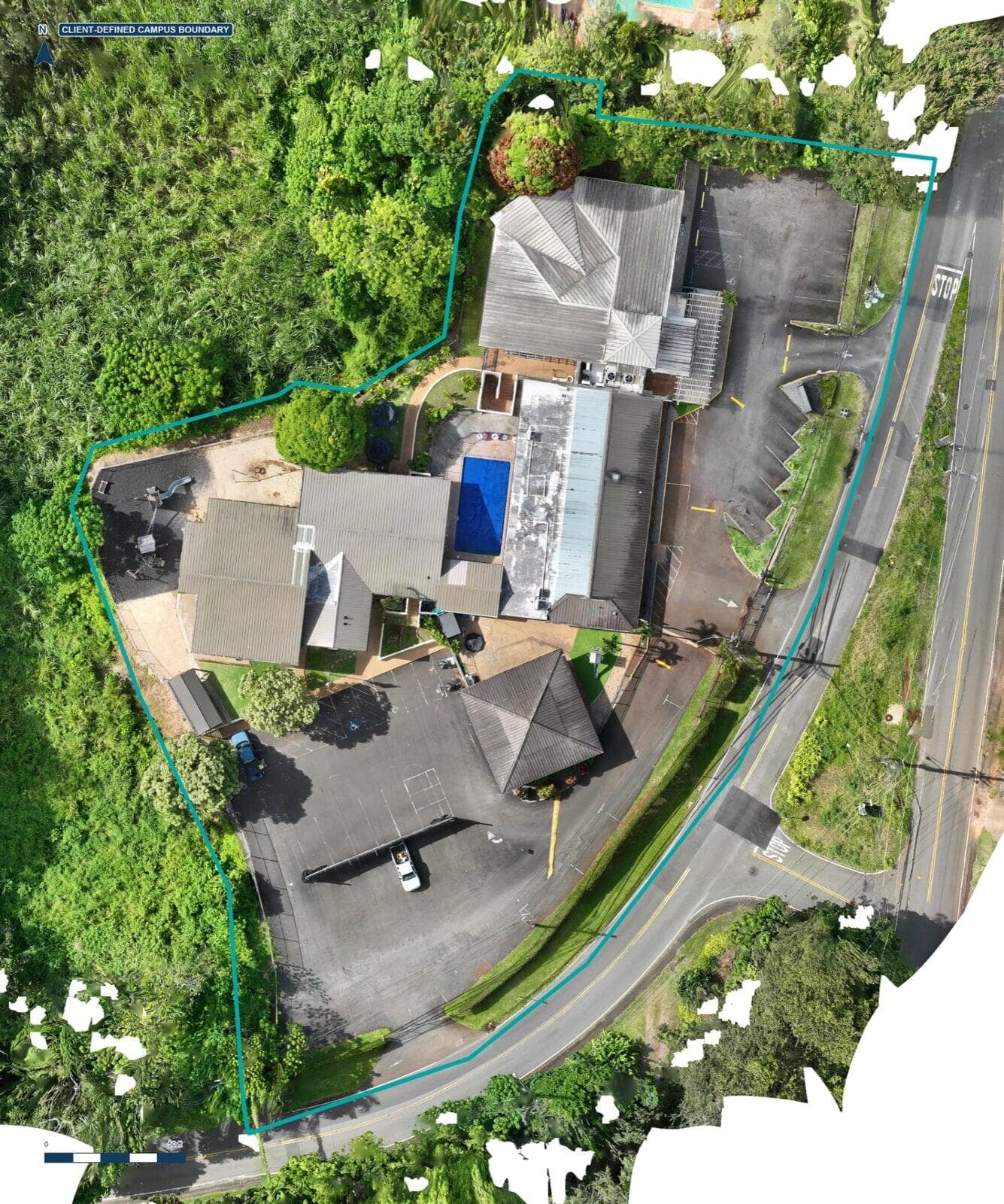
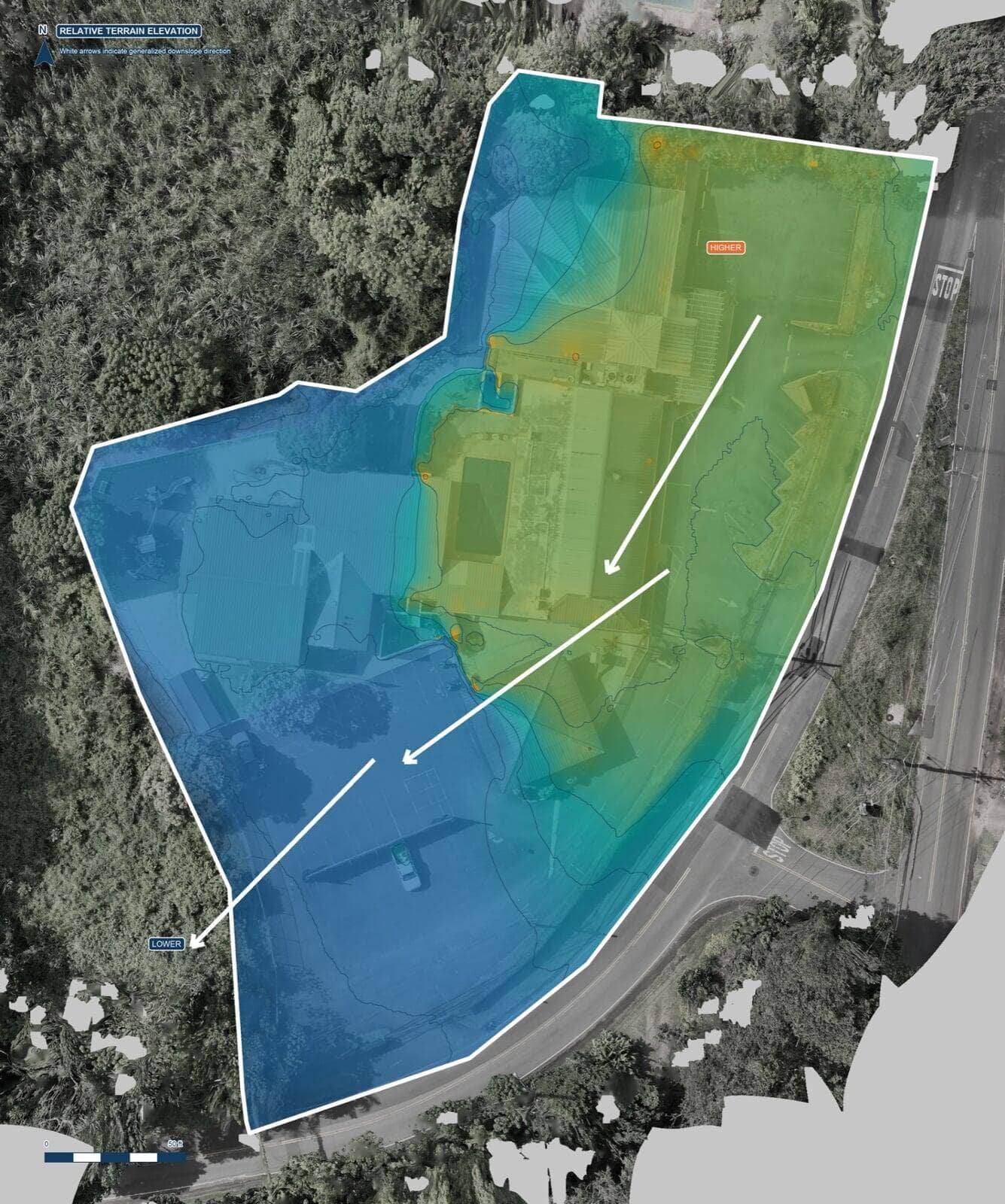
Frontier Drone Works completed a 49-image aerial mapping practice project at Trinity Presbyterian Church in Kailua. The package converts current aerial imagery into a clean campus overview, a facilities-planning exhibit, and a preliminary elevation and drainage-planning map for property discussions.
PROJECT SCOPE
• Process and review 49 aerial images covering the church campus.
• Map buildings, parking areas, driveways, landscaped spaces, and the client-defined property area.
• Prepare an aerial base map for facilities and site-planning conversations.
• Visualize preliminary elevation and surface-drainage patterns for follow-up field review.
DELIVERABLES
• High-resolution clean aerial campus map.
• Facilities-planning exhibit with labeled site features and orientation.
• Preliminary elevation and drainage-planning map.
• Written use limitations and recommended field-verification steps.
OUTCOME
The completed package gives church leadership a current, easy-to-read view of the campus for maintenance, facilities, and future site-planning conversations. The three exhibits separate clean visual context from planning annotations and preliminary terrain interpretation.
ACCURACY & APPROPRIATE USE
This is a practice project prepared from aerial imagery for preliminary planning and demonstration purposes. Elevation and drainage interpretations are approximate and should be confirmed by qualified professionals and onsite observations before design, construction, or engineering decisions. The work is not a boundary survey or engineering assessment.
VIEW THE COMPLETE CASE STUDY
PLANNING A SIMILAR PROPERTY PROJECT?