
Campus Facilities, Elevation & Drainage Planning
Practice Project · Kailua, Oʻahu · July 2026
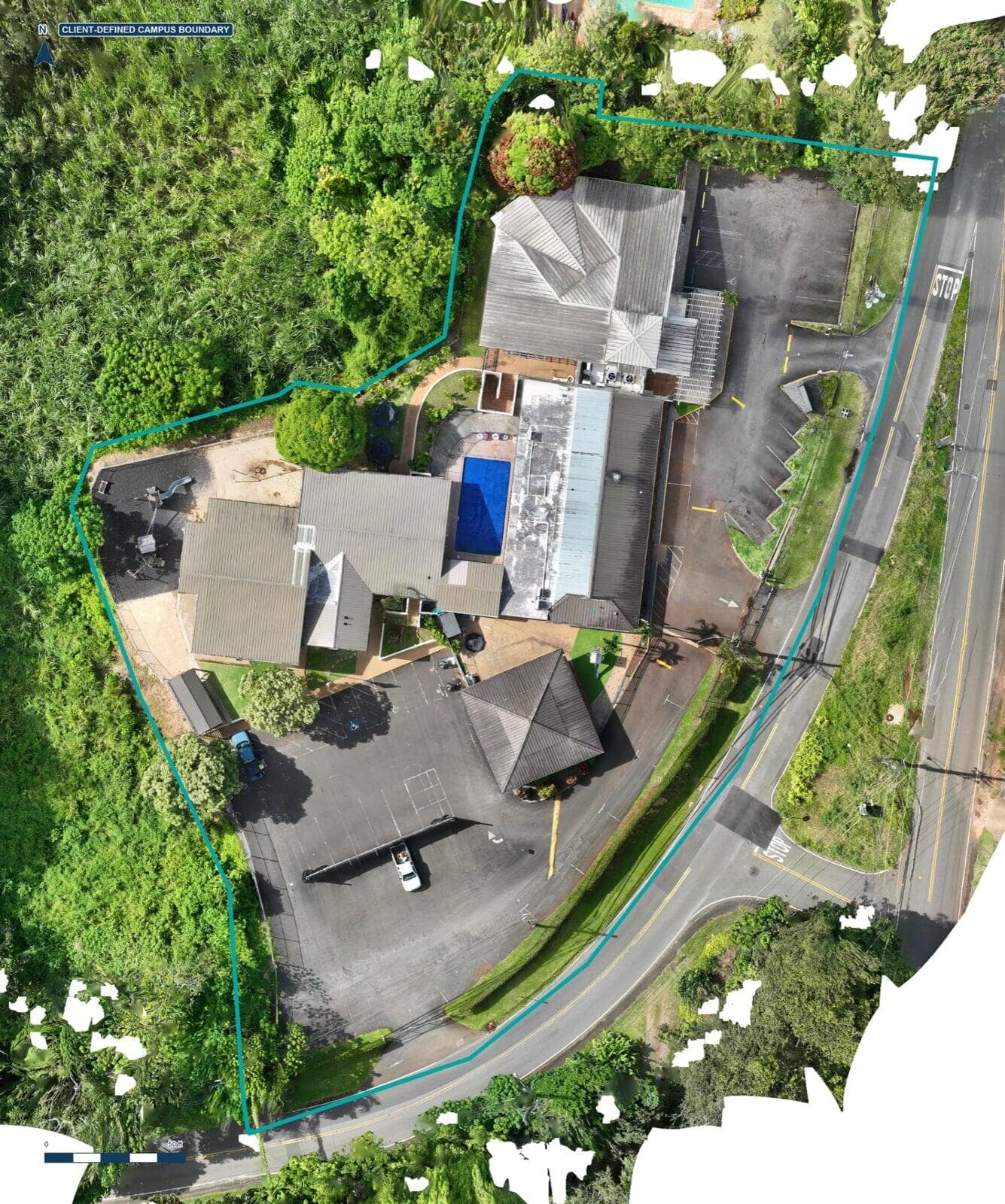
Frontier Drone Works processed 49 RTK-positioned aerial images into a client-style planning package for a fictional campus-facilities scenario. The aligned imagery produced a high-resolution orthomosaic plus clean, facilities, elevation, and preliminary drainage-planning exhibits.
PROJECT SCOPE
• Process and quality-check 49 aerial images.
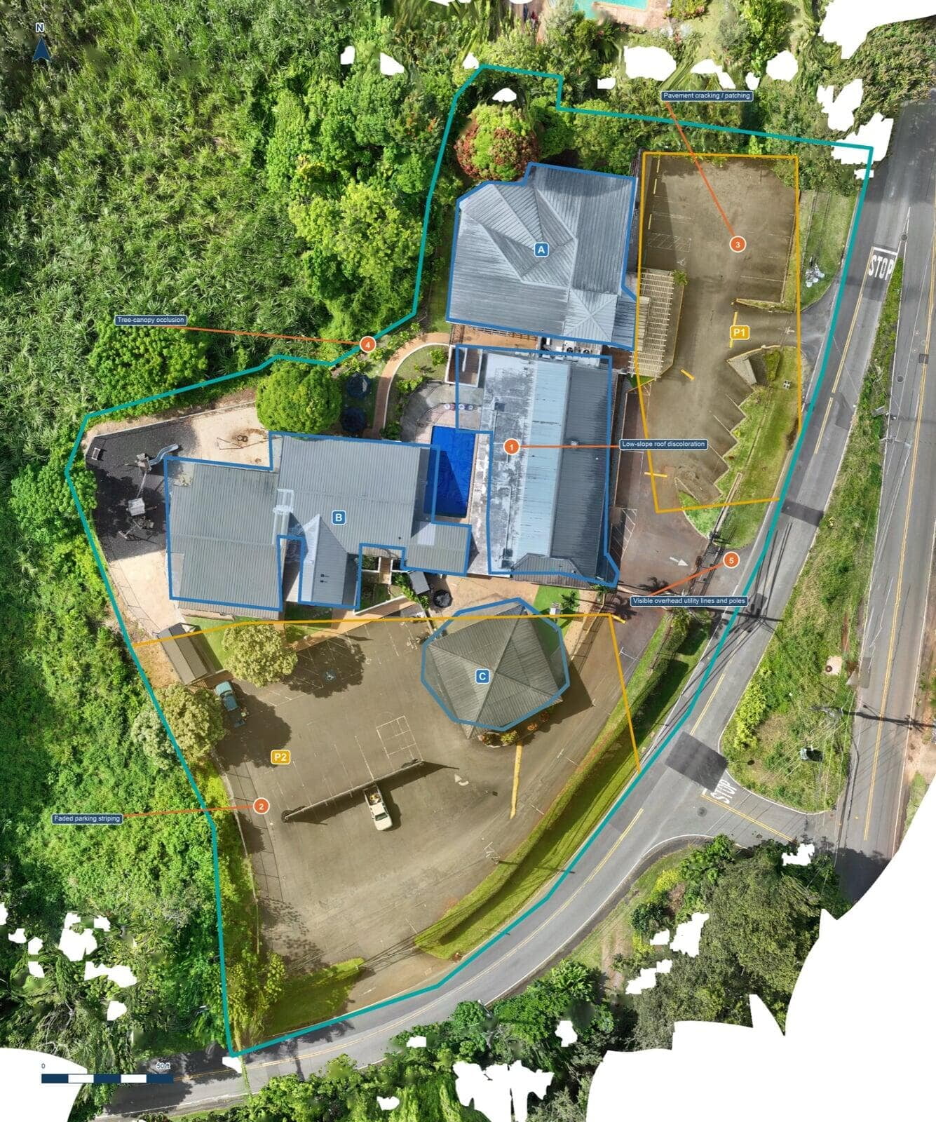
• Map campus buildings, parking, driveways, and visible site features.
• Document apparent marked parking and accessible spaces.
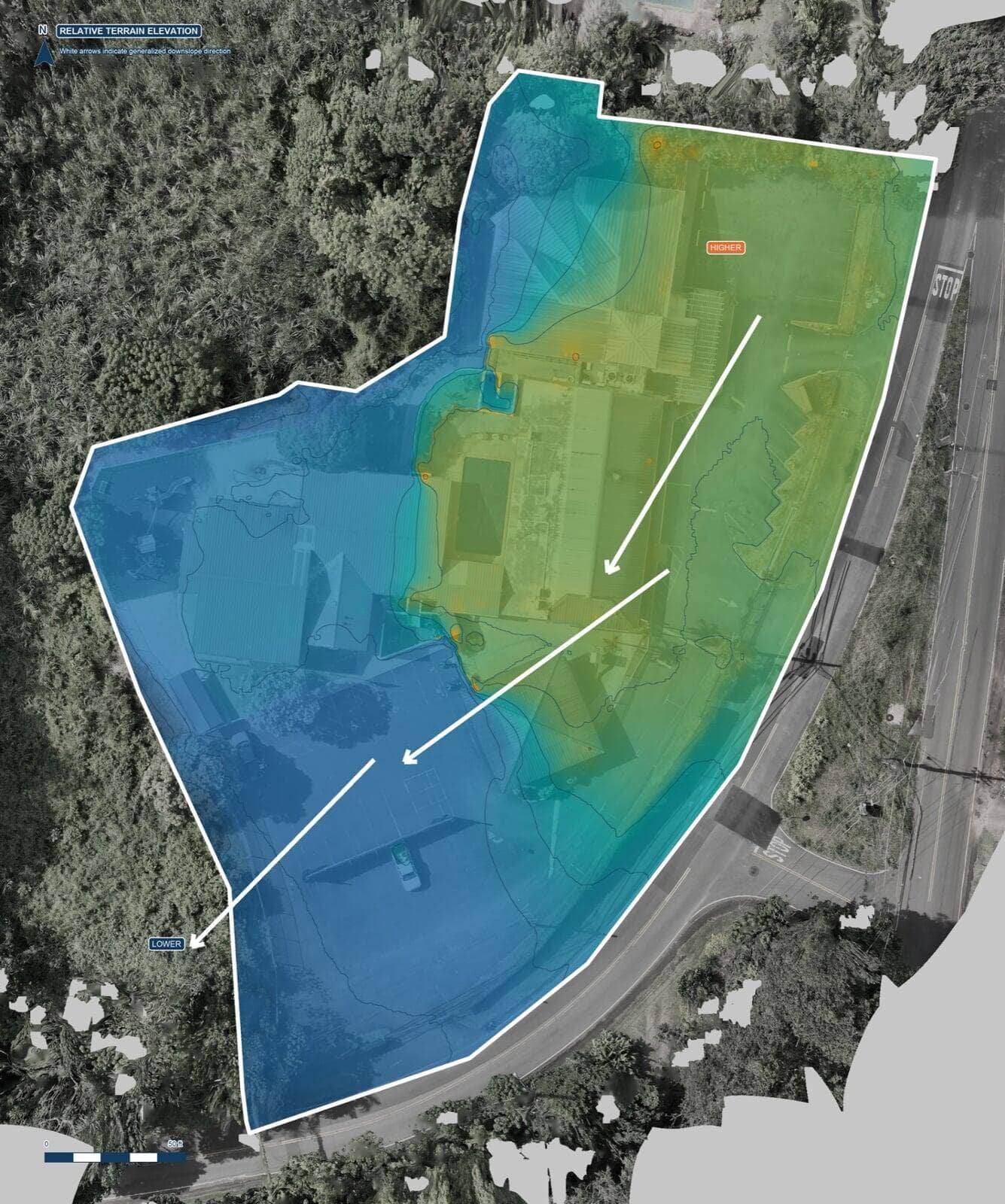
• Develop preliminary elevation and drainage-planning exhibits.
DELIVERABLES
• High-resolution clean aerial campus map.
• Facilities planning map with approximate areas, visible roof footprints, parking inventory, and site observations.
• Elevation and drainage planning map with terrain bands and preliminary flow interpretation.
• Written facilities-planning summary with findings, limitations, and recommended field verification.
OUTCOME
All 49 images aligned at 1.19 cm/pixel. The package documented an approximately 64,300-square-foot (1.48-acre) campus, an approximately 15,700-square-foot combined visible roof plan-view footprint, and an apparent 39 marked parking spaces, including 2 accessible spaces. The modeled terrain showed about 32 feet of full elevation range, with the central 90% spanning about 15 feet.
ACCURACY & APPROPRIATE USE
This practice project combines real flight data with a fictional client scenario. The imagery was RTK-positioned, but no independently surveyed ground control or checkpoints were used. Measurements and imagery-derived observations are planning-grade only. This is not a boundary survey, engineering or roof inspection, accessibility-compliance review, construction measurement, or definitive drainage assessment.
PLANNING A SIMILAR PROPERTY PROJECT?